These GPX Data products cannot be used with the Bicycle Route Navigator App! Unless you plan to use a standalone GPS device, we highly recommend purchasing route sections WITHIN the Bicycle Route Navigator app.
Please note, GPX Data is not refundable! Please examine the sample data on the device of your choice before purchasing GPX data packages. More information about GPX Data files can be found here.
After your GPX purchase, you can get GPX updates for free by re-downloading them from your My Adventure Cycling account.
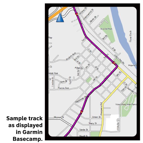
GPX Data products consist of track and service waypoint files in gpx (GPS Exchange Format) file format to be used on a GPS device, smartphone, or tablet. These products are suggested as a companion product to the printed Adventure Cycling Route maps and feature the same services listed on the physical maps. More information about GPX Data for Devices can be found here.
Ride this iconic route, often called, “The Main Street of America,” made famous in popular songs, literature, television and movies. ‘Route 66,’ became a reality as a highway in 1926 connecting Chicago and Los Angeles. Many buildings, signage, and businesses can still be seen along this route.
More information about this route is available here.
* These products are delivered in compressed zip files. Instructions on extracting the data are located here.
**NOTE: Occasionally, the GPX data you purchase will be newer than the paper map currently being sold. They may still be used together. See the Tracks and Service Points FAQsfor more information.**
I really wish corrections would be implemented in digital data as fast as possible. It should be easier. And there is information that you don't get like, you need to pay to cross petrified wood park. Road conditions. That you might get in the paper maps or maybe not even there.
So it is a good route to follow if nothing has changed.
/////////////// Response from Adventure Cycling:
We are still working out the process for how often the digital data files will be republished. Theoretically, it should be easy to make changes and republish these digital files more often than the paper maps. In reality, there are over 100 (and growing) files to keep updated while still maintaining the paper maps and our other tasks. At this time, if we become aware of a safety issue on a route or of a mandatory detour (such as the mudslides on the California coast) we will update the files and republish them.
Not worth purchasing
Rating:
Reviewed By:
Dan Wiessner on 9/26/16
I had high hopes for this app before we left on our 2700 mile Route 66 adventure. We completed the ride in 53 days and rarely used the app. It was difficult to understand in the first place. I even uploaded another app called "Easy Tracker" to help but to no avail. We relied on the paper maps almost exclusively.