Arkansas High Country Route Map Set GPX Data


Please note, GPX Data is not refundable! Please examine the sample data on the device of your choice before purchasing GPX data packages. More information about GPX Data files can be found here.
After your GPX purchase, you can get GPX updates for free by re-downloading them from your My Adventure Cycling account.
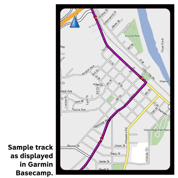
GPX Data products consist of track and service waypoint files in gpx (GPS Exchange Format) file format to be used on a GPS device, smartphone, or tablet. These products are suggested as a companion product to the printed Adventure Cycling Route maps and feature the same services listed on the physical maps. More information about GPX Data for Devices can be found here.
The route is comprised of three large adjacent loops: the South Loop, the Central Loop, and the Northwest Loop. The South Loop, on map section 1, begins and ends in Little Rock. The Northwest and Central Loops, on map section 2, begin and end in Bentonville and Russellville, respectively. A cyclist can choose to ride one or more of the loops, or ride the perimeter of all the loops – it’s up to you.
An additional choice on the South Loop features two singletrack options, using the entire Lake Ouachita Vista Trail (LOViT), and the southern portion of the Womble Trail. Both are International Mountain Bike Association (IMBA) EPIC trails.
Since the routing on the three loops is roughly 50% gravel and 50% pavement, choose your bike carefully. Riders who are in a hurry will choose a race geometry gravel bike. Those who choose comfort over speed will elect for full suspension or fat tires to pad the ride. Much of the gravel roads are easily ridden, but there are sections with washboards and cathead boulders. A minimum of 37mm tires with some tread is highly recommended.
GPX Data Resources
- GPX Data Agreement
- Support Pages for Digital Route Data products
- Map Updates and Corrections (Addenda) - Always be sure to check for map updates and corrections before leaving on your trip.
- Temporary Road Closure Information
- Frequently Asked Questions
* These products are delivered in compressed zip files. Instructions on extracting the data are located here.
**NOTE: Occasionally, the GPX data you purchase will be newer than the paper map currently being sold. They may still be used together. See the Tracks and Service Points FAQs for more information.**
You may also like:


Reviews
There are currently no reviews for this product, be the first!