Roll Right from Your Door in Seattle
“Step out onto the Planet. Draw a circle a hundred feet round,” instructs poet Lew Welch. “Inside the circle are 300 things nobody understands, and maybe nobody’s ever really seen. How many can you find?” he challenges us.
If we expand the hundred feet to 100 miles, we find the Puget Sound region in Washington State rich with routes in any direction. Bike overnights, often with a ferry assist, make for local adventures. The slow pace of adventure cycling allows you time and space to look carefully at new things — birds, trail side plants sometimes ripe with summer fruit, tides, beaches, and beauty — and look within, so that within that circle a hundred feet or a hundred miles around, you can find home and your place on the Puget.
Center yourself in your region and take the time to explore those 300 or more things and find the joys in what lies right around you. The route may lead to questions and better understanding about the place, about people, and about the region. When you are centered and consider your home the hub, you’ll find bespoken routes right from the door.
Ride right from your door.
Seattle is my hub in the Puget. While I bike commute daily as a place-based educator, these four journeys are favorite bike overnights, or longer excursions, often with a ferry assist. Point your compass in any direction and enjoy these local adventures perfect for just about anyone.
Go West! Just across the sound the table is set.
Puget Sound is both a region and a body of water. From the slow pace of the pedal, you have the opportunity to be more attentive to this unique place on the planet and marvel at both the body of water and the region of important cultural, natural, and historical beauty. Puget Sound is home to the Coast Salish people, who have been stewards of this region’s land and waters for thousands of years.
A ferry assist on this western route is easy because Washington State is the largest ferry operator in the United States, and the second-largest vehicular ferry system in the world. Cyclists need no reservations and can roll on down to the Seattle Ferry Terminal at Colman Dock in downtown Seattle for many options. This adventure heads to Bainbridge Island on a short thirty five minute crossing. Wait for the WADOT staff to holler, “Bicycles,'' and roll right on to the magic of a ferry. Secure your bike on the yellow railings with a rope, and stand either on the car deck, watching the water’s many colors as it froths, or climb up to the viewing deck to admire a unique view of the city skyline and Mt. Rainier, known as Mount Tahoma in the language of the Coast Salish peoples.
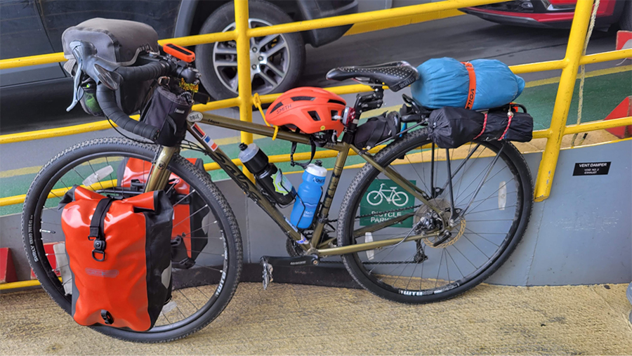
Wave to the waves of the Salish Sea and perhaps a harbor seal as you approach the dock at Winslow. If you need provisions, turn left at the traffic light rolling past the excellent Bainbridge Island Art Museum, to find ample cafes, and shops. The Town and Country Market offers a full range of groceries plus local treats.
Head east of Highway 305 to Ferncliff Ave, until left on Lofgren Rd. Then, Moran to Madison to Manitou is mmm so good with stunning views back to the city overlooking Muren Cove. As you climb to the dedicated bike/pedestrian path, there is a lovely bench set for you to sit and soak it up. Roll into Rolling Bay for more cafe options, a corner convenience store named Jiffy Mart, and a winery before turning right on Sunrise Dr. The rollers are fun, with low traffic, and peek-a-boo views of the water to your right through mossy tree trunks, ferns, and fences. The final downhill to Fay Bainbridge Campground and the water is rewarding. The open grassy hiker biker site is just $7 a night per person, with dedicated picnic tables. Leap over a large driftwood to the rocky shore just a stone's throw from where you’ve pitched your tent. Even the locals love how sunset throws alpenglow on Mt. Tahoma and paints it with pinks and purples, while city skyscrapers tip their hats over the Magnolia Bluffs.
“When the tide is out the table is set.” This adage from our Coast Salish elders is true not just for us humans but for other marine foragers like the otter and eagle. Look for them on a low tide walk.
There is bounty in the sound. By bike, the world is your oyster.
Trip length: About 10 miles, each way.
Going Further
You can extend this route a few ways. Ride north over the Agate Pass bridge towards Poulsbo, following Big Valley Road to Four Corners and just on to Kitsap Memorial State Park. Or combine the two parks for a two night adventure. Retrace your ride, or a loop is possible returning south via Silverdale and then take the Bremerton Ferry back to Seattle.
Keep going
Link to Adventure Cycling's Pacific Coast Route or Washington Parks Route by crossing over the Hood Canal Bridge to the Olympic Peninsula, connecting Highway 104 to enjoy the fabulous Olympic Discovery Trail. Keep going beyond to Highway 101.
North: Rails to Trails and Palettes of Place
A region rich in timber and marine resources needs a way to transport both goods and people. Trains were once the choice of transportation, connecting growing Northwest cities with ribbons of rails between communities. Such is the Interurban Trail that follows the route once used by the electric Interurban Railway between Seattle and Everett from 1910 to 1939. In the 1990s it was converted to a lovely car-free rail trail. From north Seattle, one can ride a 24-mile route through the towns of Shoreline, Mountlake Terrace, Edmonds, and Lynnwood. It’s mostly a wide, paved, off-road route, but several small gaps are bridged with bike lanes, wide shoulders, sidewalks, and low traffic streets. Notice the art along the path, and seasonal flora. Wonder what spring wildflower is the first to bloom in this area.

Head northwest from Lynnwood and ride more or less parallel to the Mukilteo Speedway by the Harbor Point Golf Course; make the final descent to the new Mukilteo ferry terminal that opened in December of 2020 in a longhouse architectural form, derived through close collaboration with numerous Coast Salish Tribes. The ferry to Whidbey Island brings you to Clinton. There are a few Warmshowers hosts in both Clinton and Langley and the only public campground on South Whidbey is the iconic Fairgrounds Campground in lovely Langley. Fold up a big slice of pizza from Village Pizza or open up to outrageous oysters from Saltwater Fish House and Oyster Bar. Dive into the Langley Whale Center to learn more about the majestic marine mammals and the future of both the endangered fish-eating southern resident Orcas and the mammal-eating transient Orcas, both of which forage in Puget Sound. On the return trip, watch the water and wonder, “What color is the Puget?” You’ll find a diverse palette of place. You’ll have cycled to improve the cycle of ecology and biodiversity.
Trip length: About 30 miles, each way.
Going Further
Continue northbound on Whidbey Island to Fort Casey State Park. Fort Casey, along with Port Towsend’s Fort Worden and Marrowstone Island’s Fort Flagler once made up the coastal defense system known as the “Triangle of Fire” defending the entrance to Puget Sound at the turn of the 20th Century. This area is part of the Pacific Coast Route Section 1. You can also use one of Adventure Cycling's Short Routes with RideWithGPS data to go from Seattle to Fort Flagler.
Keep going
North Whidbey Island offers Deception Pass State Park and access to Fidalgo Island’s Anacortes — portal to the San Juan Islands. Deception Pass State Park and Washington Park in Anacortes offers camping for bikers. This area is also part of the Pacific Coast Route Section 1.
East: Salmon and Cedar and Song
The people of the Puget are salmon people. Indigenous communities depend on salmon as a staple food source, and the anadromous fish is deeply embedded in the culture, identity and existence of both Coast Salish people and other current residents in the region. Follow the salmon up river with this fresh water route heading East.
From Seattle roll south on Lake Washington Boulevard, soaring with the osprey and eagles. If you are lucky, the Boulevard, south of Mt. Baker Beach, may be completely closed to cars for a series of summer Bicycle Weekends. At the end of the Boulevard, Seward Park boasts 300 acres of forest land, including an old growth stand and a 2.4-mile car-free loop at the water’s edge of the park, both worthy of the detour.
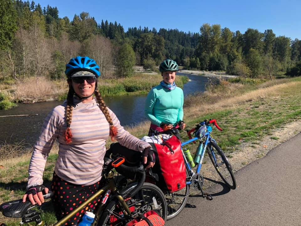
People of the Puget are cedar people. The tree is a key natural resource, but the tree also plays an integral spiritual and ceremonial role. From Renton, the Cedar River Trail follows the river for 17.4 miles from the mouth of the river where it empties into Lake Washington to the Cedar River Watershed boundary at Landburg. The well-signed trail runs between the river and State Route 169 towards Maple Valley. Shift right to continue on the Cedar to Green River Trail passing through a tunnel along the packed gravel route. Leave the trail in Maple Valley where provisions, cafes, and chain food stores are plenty. The route continues on SE Kent-Kangley Road which turns into Retreat-Kanaskat Rd SE in Ravensdale. The red-sided Ravensdale Market on the corner is worth a stop. It offers everything from chips to soft drinks, beer to frozen meals, ice and worms for fishing. Grab an ice cream sandwich and linger a moment on the front porch. If you listen closely you’ll hear the chatter of the stellars jay and the chirp of the Douglas squirrel from the tall cedars above. Keep listening and you'll likely hear conversational comings and goings of this sort of community center in this rural town where Grammy award winning singer-songwriter Brandi Carlile grew up.
It’s a steady climb up river now on Cumberland Kanasket Road. Views of Tahoma/Mt. Rainier pop up over electrical substations. The road has ample shoulders and little traffic. First cross over the railroad tracks on a bridge above, then cross over the Green River, and you are just one turn away from the Kanaskat-Palmer State Park.
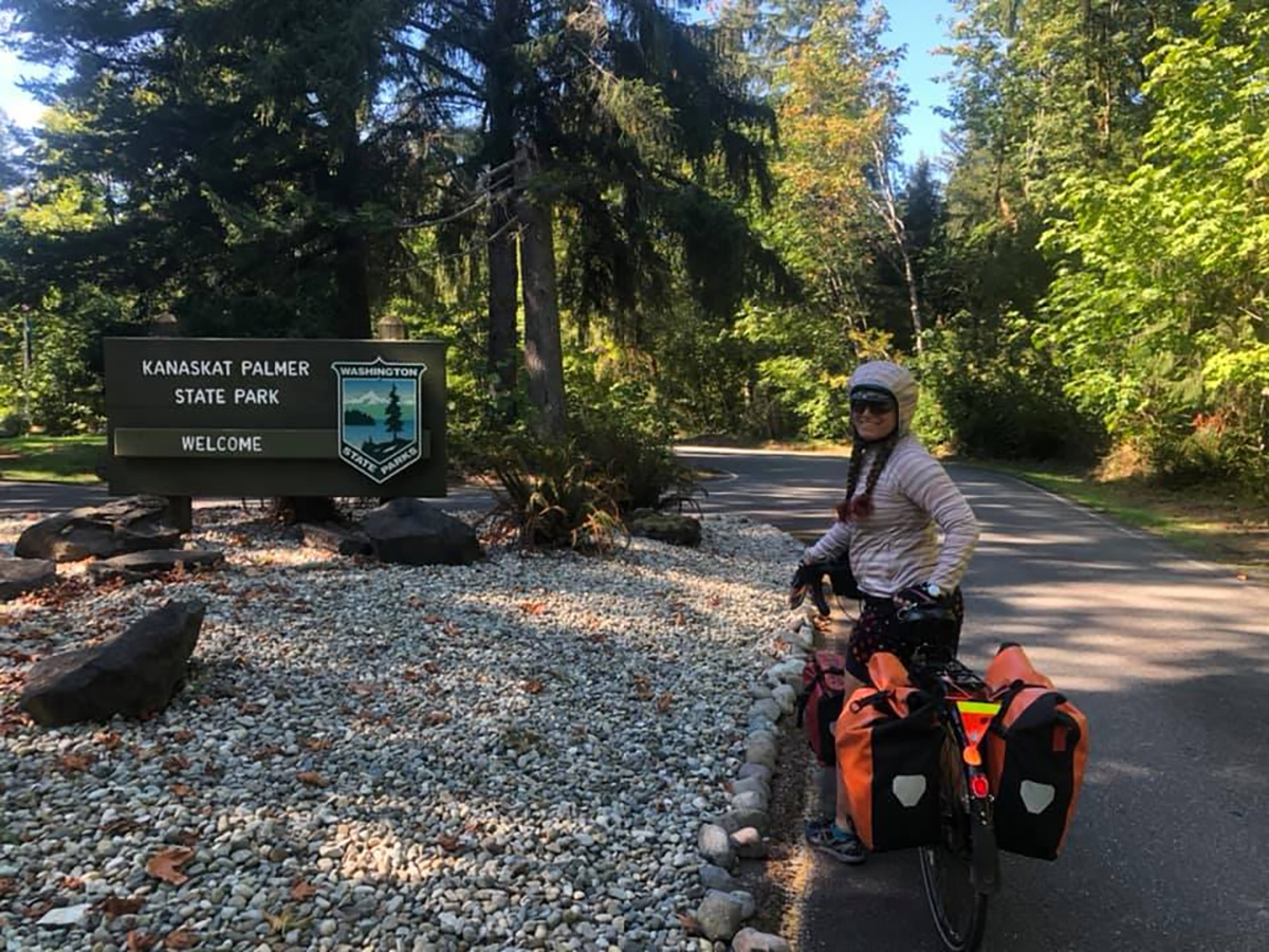
In September, big leafed maple leaves and hemlock needles made ocher and gold confetti on the picnic table in the camp site. Walk to the river and just beyond the group camp, and listen to the smooth river stones tumble under your feet. Soak your legs in the swimming hole, the cool water calming your calves. Discover signs of salmon. Dorsal fins cut the shallow waters with wiggles, and seek the shimmery scales to catch sunlight in their gravity defying leap into the autumn air. From a rocky perch, the river may be red with writhing, gravel below flecked with roe. You, just like the fish, arrived under your own power.
While the salmon finish their journey here, you’ll return to Seattle via the same route. You can view a similar Seattle to Kanasket-Palmer plan via one of Adventure Cycling's Short Routes.
Ride length: About 36 miles, one way.
South: Timber and Tides
Singer Neko Case “wants to tell you a story about her hometown, [the] dusty old jewel in the South Puget Sound.” Tacoma is a roll-right-from-your-door destination where timber industry and tide flats tell stories.
Head south along Lake Washington Boulevard and Renton as you did heading east. From Renton, wind your way to meet up with the King County Interurban Trail that links Tukwila, Kent, Auburn, Algona, and Pacific along a nearly straight, 14-mile alignment following the historic Interurban Rail Line. The trail follows the BNSF railroad south, as the landscape passes through historic industrial areas and suburban lands, passing the Emerald Downs race track. There are picnic tables at nearly every major town intersection, or you can pull off the trail a few blocks for ample food options, mostly at chain restaurants like Jack in the Box or Starbucks.
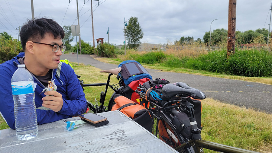
You’ll head west along busy Jovita Blvd East and after a brief section on Enchanted Parkway South, you'll pick up the lovely forested descent on the Milton Interurban Trail. It’s a respite of quiet and green, shady and cool dappled light — a perfect paved pitch to stand in your pedals and soak up the scene.
You can continue to Tacoma, on a bike lane along the busy Pacific Highway East, seeking hosts and hotels in the timber town. Yet, seek the tide flats North of Commencement Bay by camping at Dash Point State Park. From Milton, you’ll head northwest to the state park hidden in plain sight. This park offers miles of forested hiking and biking trails, but its main draw is the sandy beach. Low tide turns the sand flats into a play destination for locals, families with children and hip skimboarders surfing the shallow water. How do the barnacles cling to rocks? What’s in the tidepools?
Trip length: about 45 miles, one way.
Going further
Make it a loop. Ride from Tacoma along Ruston Way to Point Defiance, a 760 acre park that includes cycling paths, a rose garden, and the Point Defiance Zoo and Aquarium. It’s also the ferry dock for the Point Defiance-Tahlequah route to Vashon Island. You can catch the ferry north, ride the spine of Vashon Island, and catch the Vashon-Fauntleroy Ferry to West Seattle. Then enter Lincoln Park and ride the walking path that turns to a very rideable section of gravel.
Keep going
Connect to the Yelm-Tenino Trail, which is part of Washington Parks Route Section 2.
Mix it up
A new fast ferry from Des Moines to Seattle may offer a delightful variation loop. Leaving four times each day Wednesday through Sunday.
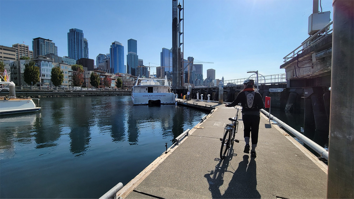
Overnight Trips from Seattle
Adventure Cycling Association is building a Short Routes program. Short routes are two- to five-day bicycle routes and itineraries from major metro areas. Crafted with the beginner adventurer in mind, these routes offer fun, accessible ways to shake up the weekend, and experience the surrounding areas at the pace of a pedal stroke. At present, two of these journeys leave from Seattle: Seattle to Ft. Flagler, Seattle to Kanasat-Palmer, and Seattle to Lopez Island.


Comments
The link to the Interurban Trail from Seattle to Everett is incorrect. That link points to the Interurban Trail from Seattle to Auburn, i.e., southward instead of northward. It also includes a bunch of other great trails in King County.
These links point to the northern portion of the Interurban Trail:
https://www.snohomishcountywa.gov/Facilities/Facility/Details/Interurban-Trail-69
https://www.traillink.com/trail/interurban-trail-(north)/
Thank you. This link has been corrected.
Forgot Password?
Enter your email address and we'll send you an email that will allow you to reset it. If you no longer have access to the email address call our memberships department at (800) 755-2453 or email us at memberships@adventurecycling.org.
Not Registered? Create Account Now.