These GPX Data products cannot be used with the Bicycle Route Navigator App! Unless you plan to use a standalone GPS device, we highly recommend purchasing route sections WITHIN the Bicycle Route Navigator app.
Please note, GPX Data is not refundable! Please examine the sample data on the device of your choice before purchasing GPX data packages. More information about GPX Data files can be found here.
After your GPX purchase, you can get GPX updates for free by re-downloading them from your My Adventure Cycling account.
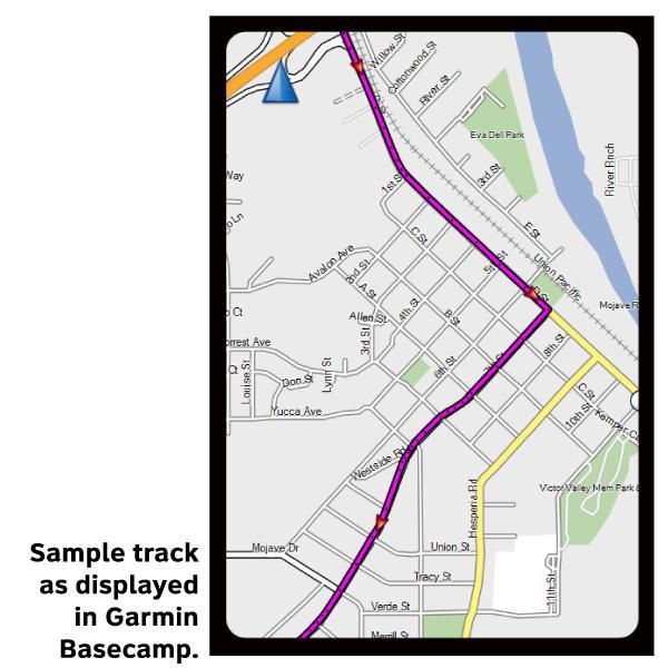
GPX Data products consist of track and service waypoint files in gpx (GPS Exchange Format) file format to be used on a GPS device, smartphone, or tablet. These products are suggested as a companion product to the printed Adventure Cycling Route maps and feature the same services listed on the physical maps. More information about GPX Data for Devices can be found here.
Section 1 of the TransAm takes you down the Pacific coast from Astoria, founded by two expeditions outfitted and funded by John Jacob Astor and named in his honor, through the Tillamook Valley, known worldwide for its cheese. The route then heads inland near the city of Eugene, home of the University of Oregon. A spur is shown between Florence and Eugene, for those wanting quicker access to the Pacific Ocean. Astoria and Florence are both along the Pacific Coast Route.
More information about this route is available here.
* These products are delivered in compressed zip files. Instructions on extracting the data are located here.
**NOTE: Occasionally, the GPX data you purchase will be newer than the paper map currently being sold. They may still be used together. See the Tracks and Service Points FAQsfor more information.**
August 4, 2016 just completed bicycle trip from Seattle, WA to Honeyman State Park, OR (Approx 4 miles south of Florence) using ACA Pacific Coast map Astotria OR to Crescent, CA. I have used ACA maps for the pass 10 years, where possible, planning the details of my bike trip (daily destinations, distance, camp site, stores, restaurants, etc). They are a very good source of information and very useful actually on the ride. Then I used TransAm Bicycle Trail Section 1 map from Florence to Eugene, OR. to catch the train to Seattle. This is the third or fourth time over the past several years using a combination of ACA maps to plan a bike trip. Excellent maps for planning and using on the ride.
Nice items.
Rating:
Reviewed By:
Nice maps and accurate GPX file. on 6/3/16