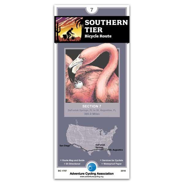
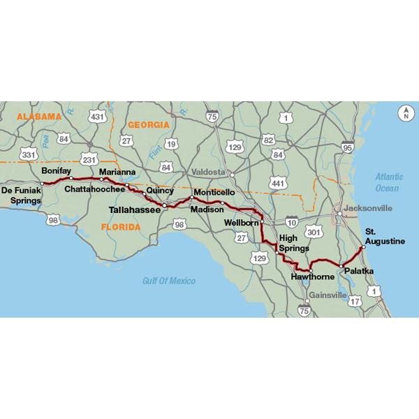
DeFuniak Springs, FL - St. Augustine, FL (390.9 miles)
Product Code
BC-1707
Brand
Adventure Cycling Association
Price
$16.75
Heading eastward across the Florida panhandle, you'll follow either US 90 or county two-lane roads. Stretches of the route between DeFuniak Springs and Tallahassee are like parks with groomed grass shoulders lined with pine forests. Tallahassee is an easy city to bicycle through, but it is urban cycling. East of Gainesville the route uses several state trails. In Palatka, use the north sidewalk crossing the St. Johns River due to heavy traffic. Another state trail takes you from East Palatka to within 10 miles of St. Augustine. Traffic increases steadily until the route ends at the intersection with US 1. St. Augustine is also a city on the Atlantic Coast Route. Click on enlargement for detail.
I recently (Dec 2021) rode this section from Tallahassee to St. Augustine. I had wanted to ride the rolling hills around Live Oak for some time. Route 90 is nice with wide shoulders. The small towns have nice main streets and city parks to rest, charge a phone, and grab a sandwich. Highlights were Monticello, Madison, High Springs, Alachua, and St. Augustine. Florida state parks are very nice. I camped at Suwannee, O'Leno, and Anastasia state parks. All are nice, but Anastasia is a gem of a park. I'd recommend taking a rest day here to explore the ancient dunes hiking, beach, and salt marsh. Also, I recommend riding into St. Augustine early in the morning to beat the tourists and explore the old city during the quiet early morning. Just wonderful!
Maps not Route
Rating:
Reviewed By:
Steve on 9/7/16
The tiny map sections are too small. In one day of riding I might switch map sections 3 time. Consider all the space on the back of the map dedicated to fairly useless stuff, you could increase each individual map size and remove the excess stuff on the back. Getting through Tallahassee was a pain with out an inlay map of the city. Considering you gave us one for Pensacola, a much easier city to navigate with only a few turns, I was surprised one wasn't offered for Tallahassee.
I rode from New Orleans to Tallahassee, 500 miles. I discovered almost immediately that the maps I thought I'd need very much were actually useless, and I only used a small portion of map 6 before abandoning the route. My phone with Google maps worked much better.
I know you folks make 40,000 miles of bike route maps, so I'd still buy again as this was my first time using your maps, but I hope the quality is better next time.
Southern Tier 7 - could do better!
Rating:
Reviewed By:
A customer from Florida on 4/3/12
I found the individual panels- in the 'north not necessarily up' format a pain to use in conjunction with other maps (which I like to refer to in case I want to use any other smaller roads from time to time). I also think that instead of the field notes I would have much preferred a larger scale map of the entire route (there is a tiny panel sized one). I believe that the field note info is readily available in other forums.
Southern Tier section 7
Rating:
Reviewed By:
A customer from Canada on 12/25/06
This is very well done, after using those maps I may be able to add comments


 based on 4 reviews.

