Southern Tier Section 6 GPX Data


Please note, GPX Data is not refundable! Please examine the sample data on the device of your choice before purchasing GPX data packages. More information about GPX Data files can be found here.
After your GPX purchase, you can get GPX updates for free by re-downloading them from your My Adventure Cycling account.
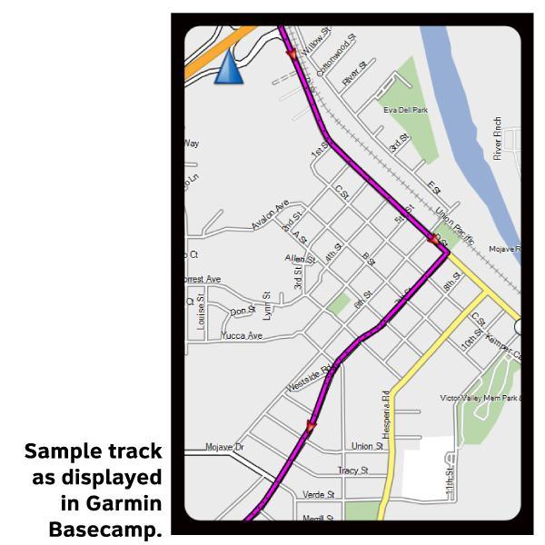
GPX Data products consist of track and service waypoint files in gpx (GPS Exchange Format) file format to be used on a GPS device, smartphone, or tablet. These products are suggested as a companion product to the printed Adventure Cycling Route maps and feature the same services listed on the physical maps. More information about GPX Data for Devices can be found here.
The route meanders through eastern Louisiana on county and state highways which are, for the most part, two-lane roads. After Tangipahoa, the countryside becomes hilly. Traffic picks up as the route enters Bogalusa. The Mississippi portion of this route is very rural and hilly. In Alabama, traffic gets busier as you near Mobile Bay. Traffic increases tremendously as the route enters and goes through Pensacola. The route uses occasional rural roads and a state highway which parallels I-10 into Defuniak Springs. If the Mobile Bay Ferry is temporarily shut down, a route around the Bay through Mobile is an option. Click on enlargement for detail.
More information about this route is available here.
GPX Data Resources
- GPX Data Agreement
- Support Pages for Digital Route Data products
- Map Updates and Corrections (Addenda) - Always be sure to check for map updates and corrections before leaving on your trip.
- Temporary Road Closure Information
- Frequently Asked Questions
* These products are delivered in compressed zip files. Instructions on extracting the data are located here.
**NOTE: Occasionally, the GPX data you purchase will be newer than the paper map currently being sold. They may still be used together. See the Tracks and Service Points FAQs for more information.**
You may also like:
Reviews
There are currently no reviews for this product, be the first!