Southern Tier Section 1 GPX Data


Please note, GPX Data is not refundable! Please examine the sample data on the device of your choice before purchasing GPX data packages. More information about GPX Data files can be found here.
After your GPX purchase, you can get GPX updates for free by re-downloading them from your My Adventure Cycling account.
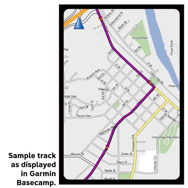
GPX Data products consist of track and service waypoint files in gpx (GPS Exchange Format) file format to be used on a GPS device, smartphone, or tablet. These products are suggested as a companion product to the printed Adventure Cycling Route maps and feature the same services listed on the physical maps. More information about GPX Data for Devices can be found here.
From San Diego you'll ride on bike paths and residential streets on a steady climb into the mountains. Dry easterly winds predominate in the fall, blowing in from the central desert. At In-Ko-Pah Pass the route joins I-8 for a short distance. El Centro and Brawley are situated in the Imperial Valley, an area famous for its agricultural bounties. Stock up on food and water here; services are extremely limited on the next stretch of the route. SR 78 heading to Blythe carries a moderate amount of traffic. To the north you will see the Chocolate Mountains, named for their distinctive deep brown color. The terrain from Ehrenberg, Arizona, to the section's end at Tempe remains flat, with the exception of a few gentle grades. After leaving I-10, the route follows US 60, which has good shoulders. At Wickenburg the route turns south and approaches the metropolitan area surrounding Phoenix. Click on enlargement for detail.
More information about this route is available here.
GPX Data Resources
- GPX Data Agreement
- Support Pages for Digital Route Data products
- Map Updates and Corrections (Addenda) - Always be sure to check for map updates and corrections before leaving on your trip.
- Temporary Road Closure Information
- Frequently Asked Questions
* These products are delivered in compressed zip files. Instructions on extracting the data are located here.
**NOTE: Occasionally, the GPX data you purchase will be newer than the paper map currently being sold. They may still be used together. See the Tracks and Service Points FAQs for more information.**
You may also like:

Reviews
There are currently no reviews for this product, be the first!