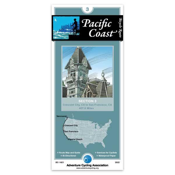
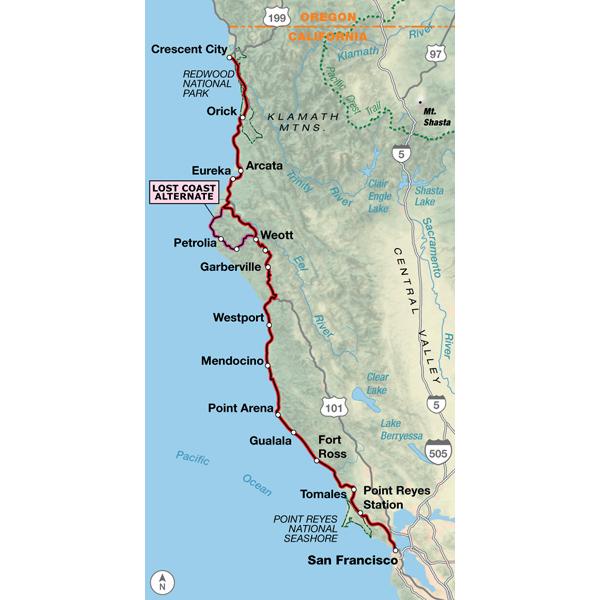
Crescent City, CA - San Francisco, CA (407.8 miles)
Product Code
BC-1621
Brand
Adventure Cycling Association
Price
$16.75
Because the heavy motorized traffic tends to be even heavier in the summer, we recommend that you ride this route in the spring or autumn. If riding in summer is your only option, be advised that motorized traffic often increases after 10:00 a.m. You'll encounter climbs several miles in length as the route crosses two major headlands between Crescent City and McKinleyville. This is redwood country, so take some extra time to enjoy the scenery in the state and national parks along the route. At Leggett you'll leave US 101 and return to the coast via SR 1, but not before climbing abruptly to 2,000 feet above sea level. From either direction this roads is a steep, twisting climb and descent on a narrow roadway that is hemmed in by heavy forest cover. From Westport to Bodega Bay SR 1 hugs the coastline, passing through small towns that cater to tourists. In Marin County, the traffic increases on the route from Valley Ford to Marshall, especially on weekends after 11 a.m. Between Fairfax and the Golden Gate Bridge you'll be riding in an urban environment. The route follows a signed bike route along residential streets and bike paths wherever possible.
I have been doing long distance touring for over 40 years and without exception these maps will exceed any expectations for the perfect bicycle tour. Purchase the maps months before the planned tour for rain average, temperature, terrain, etc. campsites and any other information required for a successful adventure. Even if you should download the computer map for your Garmin or other bike computer being able to view the next day's ride on a paper map sets the day in your mind. OBVIOUS that touring bicyclists created the maps from their years of touring.
Eureka SB
Rating:
Reviewed By:
pete Jack on 11/4/16
The route through Eureka in the inset is terrible. All kinds of twists and turns that are easy to miss and miss them I did. Why not just turn right on Broadway which you cross and has a bike lane? It's where the twists and turns bring you out at anyway about half a mile after where the maze starts.
a couple comments that may be helpful..
Rating:
Reviewed By:
mark swedlund on 6/28/15
The Map was great. I deviated once, just north Of Fort Bragg and stayed on the "official" pacific coast bike route. It was a mistake. No shoulder, too much traffic. Follow the MAP!
The "bike store" in Garberville is a bike, toy and hobby store. Very limited bike supplies when I was there.. like no CO2 cartridges.
It may not be clear from the map but there are essentially very very few services from Garberville to Fort Bragg. Just a couple gas stations. There are zero services from Leggett to Westport, so be prepared.
Patrick Points - SF
Rating:
Reviewed By:
A customer from CA on 6/5/12
Section 3 was a GREAT help! Benbow and Ave of the Giants are not to be missed.
Eureka is bit tricky but with the map's help we had a good diversion.
Review of Pacific Coast Route Section 3
Rating:
Reviewed By:
A customer from New York, NY USA on 10/26/11
Overall very good, and essential for the many times I got no cellular service in Del Norte and Humboldt counties.
Criticisms:
In Eureka, the map specifies that you follow Waterfront Drive. While this is the designated bicycle route in Eureka, it goes through a desolate, seedy part of town. Even with the added vehicular traffic, I think a route that went through town would be safer and more picturesque.
Most important, Waterfront Drive dead-ends at West Del Norte St., and the map instructs you to follow the bike path that starts at the dead end and goes down to Bayshore Mall. This bike path is DANGEROUS. There are homeless drifters and drug addicts living in tents and shacks all along this path, and it is far from any public areas or roads. The path itself is in very poor condition, with deep mud and sparse gravel. Cyclists, especially cycle tourists, should not be directed to go through here. It's an isolated area and if someone tries to mug you, there is no way for anyone to see what's happening or come to your aid. I suggest you change the route as soon as possible.
My only other criticism is that the final panel of the map, showing the route from Francis Drake Blvd. to the Golden Gate Bridge is unclear. The route from Corte Madura south to the GG Bridge is complex and the map is hard to follow.
Very nice map
Rating:
Reviewed By:
Steve Wilson on 9/9/10
The map is very durable and has lots of useful detail. Very nice to know what services are ahead in some of the remote areas where things are far apart. The only thing I would recommend to be improved is the location of some of the towns as indicated on the elevation profile. As an example, Leggett is at the bottom of a big climb, not halfway up as indicated on the profile. In planning stops on long days that can be important. Would definitely use these maps again.
Pretty good
Rating:
Reviewed By:
Anonymous on 2/16/10
I think its necessary to have this map if you're planning a bike tour. However, several key features are missing here, such as the overall distance travelled at certain points on the map. All in all, it is a must-need for a bike tour.
Useful but a few errors
Rating:
Reviewed By:
Anton Wittinger on 10/2/09
As one of the other reviewers stated the elevation profile is a little off, especially on the hill just south of Crescent City. Another change is the the campground (Mill Creek) at the top of the hill outside of Crescent City now closes after Labor Day, I found that out the hard way, so be prepared if you were planning on staying there in the month of September. I also learned that the hostel in Klamath will close for good January 13th 2010,they don't have the budget to upgrade to ADA standards and will be forced to close. Otherwise the map was great.
Pacific Coast Section 3 Map
Rating:
Reviewed By:
Skip Beck on 7/3/09
I have your Great Divide maps which are excellent. This map seems to be quite complete but have not put it to the test yet. It does not compare at all to the Great Divide maps. The 'Route Elevation Profile' could show more detail.
Pretty good, but some errors
Rating:
Reviewed By:
A customer from SF, CA USA on 7/1/09
Definitely useful, but Sections 4 & 5 were better in my opinion. I went southbound, so take that into account. A few key areas that need to be improved: 1)The hill south of Klamath had a sign at the summit that read ~1400 ft (and the hill felt bigger than the Crescent City triplet), so the elevation profile appears incorrect. This is important because you better be prepared if you skip camping in Klamath and go to Elk Prairie. 2)The location of Leggett should be farther North on the elevation profile...Leggett hill is long, and Leggett is at the base of it. Other than that, its a beautiful ride. Watch out for debris on the 101's shoulder.
ACA R&M: Regarding #1) the hill on the elevation profile south of Klamath - the Routes and Mapping staff has checked the elevations mentioned and we think anonymous was on the wrong road. His comment makes sense if he was using US 101 on map 29 instead of using the Newton B. Drury Parkway from milepoint 0 to milepoint 9.5.


 based on 10 reviews.
