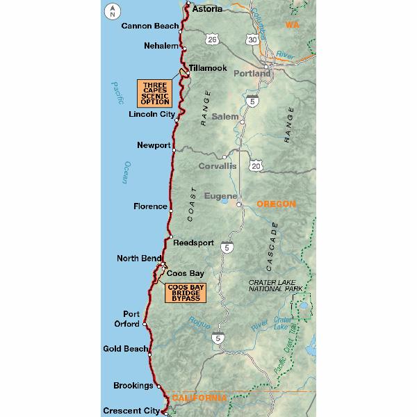
Along the Oregon Coast, the route often uses US 101, a two-lane highway popular with tourists. During the summer months and on holidays and weekends this highway carries moderate to heavy traffic. This is also timber country, so watch for logging trucks. Many improvements for bicycle traffic have been made along US 101. In places the shoulders have been widened and striped. Tunnels are well-lit, and the tunnel at Arch Cape has a flashing light that you can activate to warn motorists that you are in the tunnel. Also watch for special hiker/biker sites in the state park campgrounds. Where the route leaves US 101, the roads are generally rougher and without shoulders, but traffic tends to be light. There are some steep ascents over coastal headlands, notable between Cannon Beach and Manzanita. Traffic is heavier near and in Lincoln City, and thins again on the gentle grades around Newport and Waldport. Many of the coastal towns cater to tourists, and you'll find the views along the coast breathtaking. West of Sixes is Cape Blanco State Park, which calls itself the "most westerly Park in the continental U.S." Once you enter California, the route leaves US 101 and takes rural side roads along the level coastal plain into Crescent City.
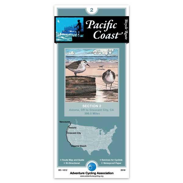
Pacific Coast - Section 2 - Astoria to Cresent City
Rating:
Reviewed By:
Larry.Moormeier on 8/8/16
August 4, 2016 just completed bicycle trip from Seattle, WA to Honeyman State Park, OR (Approx 4 miles south of Florence) using ACA maps. I have used ACA maps for the pass 10 years, where possible, planning the details of my bike trip (daily destinations, distance, camp site, stores, restaurants, etc). They are a very good source of information and very useful actually on the ride. Then I used TransAm Bicycle Trail Section 1 map from Florence to Eugene, OR. to catch the train to Seattle.
Pacific Coast Route Section 2
Rating:
Reviewed By:
Jim Powers on 12/10/10
Like all the Adventure Cycling Association maps this one is full of useful information about not only the roads but services like lodging, camping, food etc. They describe riding conditions and weather with charts of average temps and precipitation for different times fo year. Indispensable.
Bike Touring News
Ouitstanding maps
Rating:
Reviewed By:
Jeffrey Gill on 3/27/10
Rode the Pacific Coast with my son last spring and used these maps. We found them to be very accurate and mostly up-to-date. They were a real partner with us on our adventure. Unfortunately, our last evening in Oregon, we accidentally left our Oregon and Northern California maps in a restaurant and have mourned their loss ever since. Used a different map for Northern California, and it was not nearly as good.
Helped me ride the Oregon coast in 6 days
Rating:
Reviewed By:
Dan Harris on 12/7/09
The map was very helpful - especially helped in previewing all the climbs thus helping me gauge my goal for the next day.
Be advised, however, that even if the map doesn't indicate it, about EVERY small town on the coast DOES have a motel (for those who aren't camping).
Pacific Coast Hotels
Rating:
Reviewed By:
A customer from Crescent City, CA on 10/3/09
Your map was very helpful but I think you need to review and update your motel suggestions. In Gold Beach the Beachcomber is nolonger a Best Western and is in poor repair. I live in Crescent City and I'd remove all three motels from your list. The Hampton Inn is nice but too expensive. The Del Norte Motel and the City Center Motel I would have a hard time sending my worst enemy to. Check out the Best Westerns, Value Inn, Lighthouse Inn and the Anchor Way Motel. They are all on 101 and close to eating establishments.
Very Useful!
Rating:
Reviewed By:
Anton Wittinger on 10/2/09
I only used this map for part of the Oregon Coast (Florence to Crescent City) it was extremely handy and very well thought out. The only changes that I would think useful would be putting the mile post numbers at the match points so there is a way to plan your distance, but that may just be my preference. Glad I had it along with me!
Great map!
Rating:
Reviewed By:
Anonymous on 6/11/09
Excellent route map with very detailed descriptions and wonderful elevation feature.