Vancouver, BC - Imperial Beach, CA (1,853.4 miles)
Product Code
BD-16
Brand
Adventure Cycling Association
Price
$49.00
These GPX Data products cannot be used with the Bicycle Route Navigator App! Unless you plan to use a standalone GPS device, we highly recommend purchasing route sections WITHIN the Bicycle Route Navigator app.
Please note, GPX Data is not refundable! Please examine the sample data on the device of your choice before purchasing GPX data packages. More information about GPX Data files can be found here.
After your GPX purchase, you can get GPX updates for free by re-downloading them from your My Adventure Cycling account.
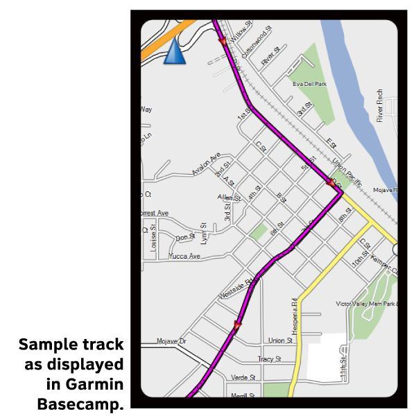
GPX Data products consist of track and service waypoint files in gpx (GPS Exchange Format) file format to be used on a GPS device, smartphone, or tablet. These products are suggested as a companion product to the printed Adventure Cycling Route maps and feature the same services listed on the physical maps. More information about GPX Data for Devices can be found here.
The scenic Pacific Coast Route travels from Vancouver, B.C., to Imperial Beach, California. Breathtaking cliffs, redwood forests, lighthouses, beaches, and a rugged coastline make this a very popular route. Discover the beauty to be found between Canada and Mexico.
More information about this route is available here.
*Note: These tracks include distances on ferries. Total mileage will differ from paper map mileage.
* These products are delivered in compressed zip files. Instructions on extracting the data are located here.
**NOTE: Occasionally, the GPX data you purchase will be newer than the paper map currently being sold. They may still be used together. See the Tracks and Service Points FAQsfor more information.**
This was a valuable resource. I found myself using it more than any other mapping service. I would have liked to have had scans of the paper maps, and would have been willing to pay for them for mileage indicators and relevant information. Also, GPS tracks were good, but the points of interest weren't marked, just little dots to change into relevant icons (I used Pocket Earth for iOS). Recommended!