Northern Tier Section 8 GPX Data


Please note, GPX Data is not refundable! Please examine the sample data on the device of your choice before purchasing GPX data packages. More information about GPX Data files can be found here.
After your GPX purchase, you can get GPX updates for free by re-downloading them from your My Adventure Cycling account.
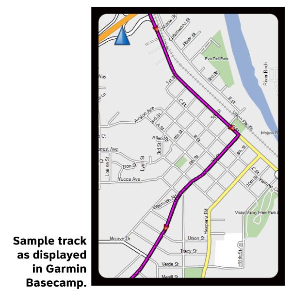
GPX Data products consist of track and service waypoint files in gpx (GPS Exchange Format) file format to be used on a GPS device, smartphone, or tablet. These products are suggested as a companion product to the printed Adventure Cycling Route maps and feature the same services listed on the physical maps. More information about GPX Data for Devices can be found here.
Grades in the Lowlands, where this section is located, are minimal, if not nonexistent. The elevation rises less than 500 feet between Iowa and Ohio. One of the few places where hills are noticable is in east-central Indiana, around the Salamonie River and Mt. Hope Recreation Areas. By and large, you'll have great visibility ahead and behind. The tall corn, however, can screen everything to the sides. Listen for vehicles approaching from the fields; some farmers don't stop when they drive onto the roads. The corn can also hide street signs when it gets high. The most notable feature of the route is the constantly changing quality of the roads. The county roads, however, have one saving grace- they are virtually unused. Even local traffic stays on the better-maintained state highways. Traffic does increase during harvest, when all those soybeans have to get to market. Roads around the Tippecanoe River and Salamonie River Recreation Areas in Indiana get busier when the weather gets warmer, especially on weekends.
More information about this route is available here.
GPX Data Resources
- GPX Data Agreement
- Support Pages for Digital Route Data products
- Map Updates and Corrections (Addenda) - Always be sure to check for map updates and corrections before leaving on your trip.
- Temporary Road Closure Information
- Frequently Asked Questions
* These products are delivered in compressed zip files. Instructions on extracting the data are located here.
**NOTE: Occasionally, the GPX data you purchase will be newer than the paper map currently being sold. They may still be used together. See the Tracks and Service Points FAQs for more information.**
You may also like:
Reviews
There are currently no reviews for this product, be the first!