These GPX Data products cannot be used with the Bicycle Route Navigator App! Unless you plan to use a standalone GPS device, we highly recommend purchasing route sections WITHIN the Bicycle Route Navigator app.
Please note, GPX Data is not refundable! Please examine the sample data on the device of your choice before purchasing GPX data packages. More information about GPX Data files can be found here.
After your GPX purchase, you can get GPX updates for free by re-downloading them from your My Adventure Cycling account.
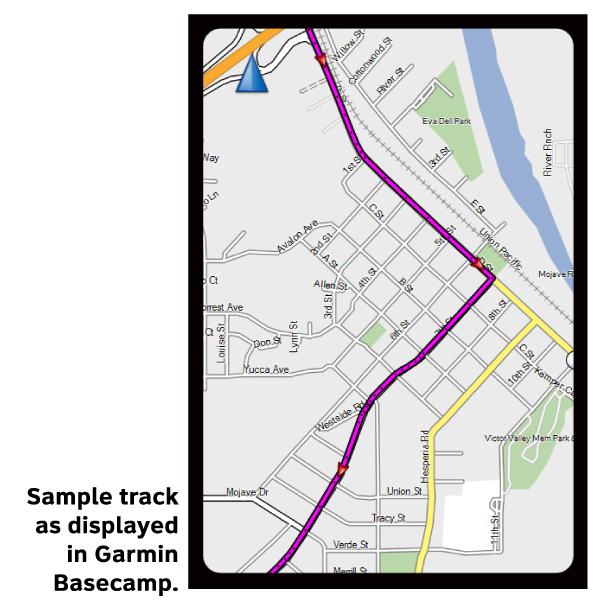
GPX Data products consist of track and service waypoint files in gpx (GPS Exchange Format) file format to be used on a GPS device, smartphone, or tablet. These products are suggested as a companion product to the printed Adventure Cycling Route maps and feature the same services listed on the physical maps. More information about GPX Data for Devices can be found here.
Soak in your choice of 50+ hot springs along this scenic loop amongst rivers and mountains located northeast of Boise. Single track options are shown on the second map in this set.
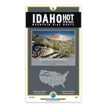
The Idaho Hot Springs Mountain Bike Route guides riders over and through the breathtaking landscape of central Idaho. From blue ribbon trout streams to sub-alpine terrain and cozy mountain towns, riders will pass through some of the most spectacular country the West has to offer, with the opportunity to indulge in the highest concentration of soakable hot springs in North America.
The Main Route Map contains routing for the main dirt road loop, the paved Lowman Cutoff, which divides the main dirt road loop in half, and the Boise Spur, which guides riders to and from the Boise Airport. The narratives for all routing on the Main Route Map are bi-directional.
The Singletrack Options Map contains routing for four unique singletrack options. The Singletrack Options Map is a supplement to the Main Route Map, and you will need to purchase both if choosing to incorporate any of the singletrack offerings into your adventure. The four singletrack options are not bi-directional. If you choose to ride them with the main route, you should go in a counter-clockwise direction.
More information about this route is available here.
(Aug 2015) ATTENTION! On August 7, 2015, President Obama signed into law the creation of three new Wilderness areas in Idaho. One of these new wilderness areas, White Clouds, encompasses trails we mapped as part of the White Cloud Option. The closures are from turn J to turn M which is 6.8 miles, and from turn P to just before turn R which is 8.3 miles. Because people are not allowed to be in possession of a bicycle in any designated wilderness area, this ends access for any bicyclist planning to ride the White Cloud Option.
The Forest Service has begun enforcing the law. If you have questions, call the Sawtooth National Forest Public Affairs Officer Julie Thomas at 208-737-3262 for more information.
* These products are delivered in compressed zip files. Instructions on extracting the data are located here.
**NOTE: Occasionally, the GPX data you purchase will be newer than the paper map currently being sold. They may still be used together. See the Tracks and Service Points FAQsfor more information.**
I did a portion of the hot springs route, from around Arrowrock dam to Ketchum this fall, and was glad I had the digital map but it took some work to actually get the gpx files into the app I use, Gaia GPS. The files come as multiple zip files and the first obstacle was finding an app to unzip them. After some research I made my way to “zip viewer” a free app whereas many of the other apps had a cost. Uploading these files into Gaia resulted in numerous maps and files which I could then open but some had waypoints and some didn’t and even now I’m not sure why there are so many different files or whether I need them all. Thru trial and error I chose one that showed all the waypoints with the USGS topo and then on the ride was able to see precisely where we were and create a track. Clearly I’m not a super tech savvy person and that’s my point I guess. I would have liked to have a product that would have simply guided me step by step thru the process. Having said all that the digital map is invaluable. I had the paper map as well which is great for a 20,000 foot overview and beta on towns, services, and of course the hot springs but knowing precisely where you are on the map is where the digital gpx tracks in conjunction with a gps device or app is so helpful.
Bingo!
Rating:
Reviewed By:
Jens on 9/12/16
Great digital resource for anyone riding the IHSR! While the maps are incredibly easy to follow and the cues are for the most part spot on (A few road numbers are incorrect when traveling clockwise) being able to use the exact GPS coordinates gives everyone the confidence you aren'y pedaling uphill in vain! I used the digital set with the IOS Pocket Earth app and had an amazing ride! I can't recommend the digital data set highly enough for the peace of mind that you are indeed in the right place and you haven't missed the hot spring! The perfect compliment to the incredible paper maps!
Good complement to physical map
Rating:
Reviewed By:
John Beaston on 8/1/16
Just completed the lower IHSMBR loop. Used with both RWGPS/iPhone and Garmin 1000. Integration of track and waypoints on RWGPS was a problem (but mostly solved with help from RWGPS support and a lot of manual tweaking). Worth the effort and a good complement with the physical map. Would be a "5" if RWGPS integration was complete.
Idaho Hotsprings GPS
Rating:
Reviewed By:
Bernhard Boser on 3/11/16
I plan to do the IHS bicycle tour in summer. At this point I only purchased the GPS tracks (not knowing if the maps, present edition from 2014) will be updated. The GPS track accurate and especially the waypoints are very useful. I've uploaded both the gaiagps (iPhone). The waypoints show on the map; clicking provides detail information. In ridewithgps I could load the gps track without problem, but not the waypoints. Help advised me that uploading this type of waypoint file in not supported in the present software. I will purchase the maps later and update my review after the tour.


 based on 4 reviews.
