


Great river route maps
Rating: 
Reviewed By: Fred Schuler on 9/16/22
These maps helped us in so many ways, I’ll definitely use them again on my next trip.
Please note, GPX Data is not refundable! Please examine the sample data on the device of your choice before purchasing GPX data packages. More information about GPX Data files can be found here.
After your GPX purchase, you can get GPX updates for free by re-downloading them from your My Adventure Cycling account.
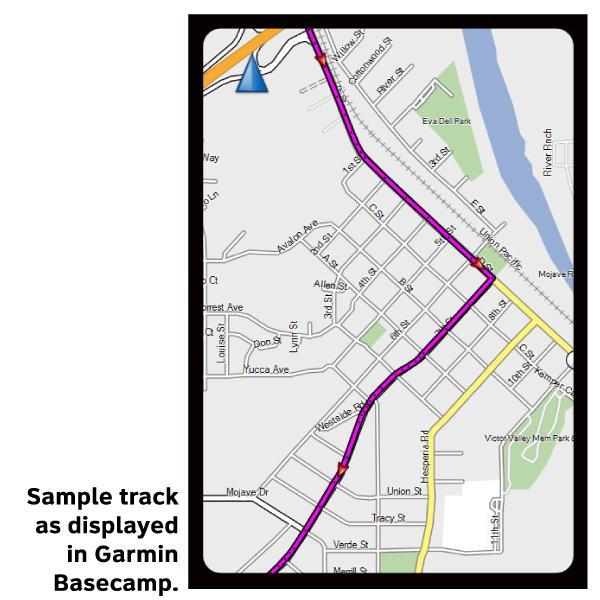
GPX Data products consist of track and service waypoint files in gpx (GPS Exchange Format) file format to be used on a GPS device, smartphone, or tablet. These products are suggested as a companion product to the printed Adventure Cycling Route maps and feature the same services listed on the physical maps. More information about GPX Data for Devices can be found here.
Explore the Mississippi on a route that would make Tom Sawyer and Huck Finn proud. Along the way visit the jumping-off spot of the Mormons' long trek west, and enjoy some great cycling in the Ozarks, and along the Natchez Trace.
More information about this route is available here.
GPX Data Resources
* These products are delivered in compressed zip files. Instructions on extracting the data are located here.
**NOTE: Occasionally, the GPX data you purchase will be newer than the paper map currently being sold. They may still be used together. See the Tracks and Service Points FAQs for more information.**
based on 1 reviews.
Rating:
Reviewed By: Fred Schuler on 9/16/22
These maps helped us in so many ways, I’ll definitely use them again on my next trip.