TransAmerica Section 5 GPX Data


Please note, GPX Data is not refundable! Please examine the sample data on the device of your choice before purchasing GPX data packages. More information about GPX Data files can be found here.
After your GPX purchase, you can get GPX updates for free by re-downloading them from your My Adventure Cycling account.
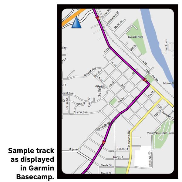
GPX Data products consist of track and service waypoint files in gpx (GPS Exchange Format) file format to be used on a GPS device, smartphone, or tablet. These products are suggested as a companion product to the printed Adventure Cycling Route maps and feature the same services listed on the physical maps. More information about GPX Data for Devices can be found here.
Section 5 of the TransAm route takes you through Yellowstone National Park, the jewel of America's National Park System, and Grand Teton National Park. Look for elk, bison, bears, and wolves as you cycle along the river between West Yellowstone and Madison, and take time to explore the many and varied geyser basins on your way to Old Faithful. On your way out of the park you will cross the Continental Divide twice, and once outside the park, a third time at the spectacular 9,658-foot elevation Togwotee Pass. Due to narrow roads and heavy traffic with lots of RV's during the summer, some cyclists are choosing to visit Yellowstone National Park by renting a vehicle and driving to see the sights. The 139-mile Teton Valley Alternate shows routing to avoid riding through the Park. A spur is also shown to Jackson, Wyoming. From Togwotee Pass, the eastern slope of the Rockies falls away before you as you cycle along the Wind River through Dubois and on to Lander. After Lander the route crosses the dry and windy Great Divide Basin and ends in Rawlins.
More information about this route is available here.
GPX Data Resources
- GPX Data Agreement
- Support Pages for Digital Route Data products
- Map Updates and Corrections (Addenda) - Always be sure to check for map updates and corrections before leaving on your trip.
- Temporary Road Closure Information
- Frequently Asked Questions
* These products are delivered in compressed zip files. Instructions on extracting the data are located here.
**NOTE: Occasionally, the GPX data you purchase will be newer than the paper map currently being sold. They may still be used together. See the Tracks and Service Points FAQs for more information.**
You may also like:

Reviews
There are currently no reviews for this product, be the first!