

trifred54@hotmail.com
Rating: 
Reviewed By: Fred Strong on 2/4/19
Trifred54@hotmail.com
Please note, GPX Data is not refundable! Please examine the sample data on the device of your choice before purchasing GPX data packages. More information about GPX Data files can be found here.
After your GPX purchase, you can get GPX updates for free by re-downloading them from your My Adventure Cycling account.
GPX Data products consist of track and service waypoint files in gpx (GPS Exchange Format) file format to be used on a GPS device, smartphone, or tablet. These products are suggested as a companion product to the printed Adventure Cycling Route maps and feature the same services listed on the physical maps. More information about GPX Data for Devices can be found here.
The Florida peninsula is honeycombed by underground springs which have caused numerous sink holes. Some of these "sinks" get to be fairly large. For example, Thrill Hill Rd. passes in and out of a 100-foot deep sink hole north of Mount Dora. Disney World is located south of Oakland and Winter Garden. Many campgrounds and motels offer shuttle service into Disney World, which would be the best way to reach this fun spot. Ranches, open scrub, and grassland near Wauchula and Arcadia lead to a (slightly) downhill ride along the tea-colored Peace River. The route is rural and well away from tourist corridors from north of Cape Coral through Ft. Myers to Ft. Lauderdale. Florida's west coast is often swampy and ringed with low-lying mangrove jungles. The route skirts the southern banks of Lake Okeechobee and access is available to ride around it on a path built by the Corps of Engineers. Historic Ft. Myers, a transportation center and access point to the famous Everglades, serves as a pivot point of the route with its ferry services.
More information about this route is available here.
GPX Data Resources
* These products are delivered in compressed zip files. Instructions on extracting the data are located here.
**NOTE: Occasionally, the GPX data you purchase will be newer than the paper map currently being sold. They may still be used together. See the Tracks and Service Points FAQs for more information.**
based on 2 reviews.
Rating:
Reviewed By: Fred Strong on 2/4/19
Trifred54@hotmail.com
Rating:
Reviewed By: Robert Hoel on 12/19/16
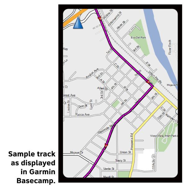
It is great not to have to replicate your printed maps into a digital format in order to load them to my Garmin device. Thanks. The next step would be that they become routes and not just tracks. But this works, none the less.