These GPX Data products cannot be used with the Bicycle Route Navigator App! Unless you plan to use a standalone GPS device, we highly recommend purchasing route sections WITHIN the Bicycle Route Navigator app.
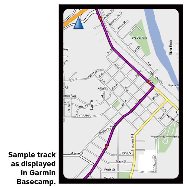
Please note, GPX Data is not refundable! Please examine the sample data on the device of your choice before purchasing GPX data packages. More information about GPX Data files can be found here.
After your GPX purchase, you can get GPX updates for free by re-downloading them from your My Adventure Cycling account.
GPX Data products consist of track and service waypoint files in gpx (GPS Exchange Format) file format to be used on a GPS device, smartphone, or tablet. These products are suggested as a companion product to the printed Adventure Cycling Route maps and feature the same services listed on the physical maps. More information about GPX Data for Devices can be found here.
You’ll encounter both flat terrain and rolling hills on this section of Bicycle Route 66. Oklahoma tends to slope gradually upward from its eastern to western boundaries. Woodlands and transitional prairie grasslands, composed of shortgrass, mixed-grass, and tallgrass prairie cover the central portion of the state. In the upper portion of Texas, referred to as the Panhandle, the Great Plains become a reality in the flat, wide open expanse of country you’ll be riding through. The route parallels I-44 between the Kansas border and Oklahoma City, then uses multiple frontage roads along I-40 between Oklahoma City and Adrian, Texas. The 12.9 miles of the route in Kansas retains much of the character of the Mother Road. Services are reasonably spaced with Tulsa, Oklahoma City and Amarillo offering full services and bike shops. West of Amarillo the route is all on roads that parallel the interstate.
More information about this route is available here.
* These products are delivered in compressed zip files. Instructions on extracting the data are located here.
**NOTE: Occasionally, the GPX data you purchase will be newer than the paper map currently being sold. They may still be used together. See the Tracks and Service Points FAQsfor more information.**
As soon as the purchase cleared, I received the notice informing me the download was accessible. I only ordered one section of the series because I am only interested, right now, in the central section. For planning purposes, not for route navigation.