Bicycle Route 66 Section 2 GPX Data


Please note, GPX Data is not refundable! Please examine the sample data on the device of your choice before purchasing GPX data packages. More information about GPX Data files can be found here.
After your GPX purchase, you can get GPX updates for free by re-downloading them from your My Adventure Cycling account.
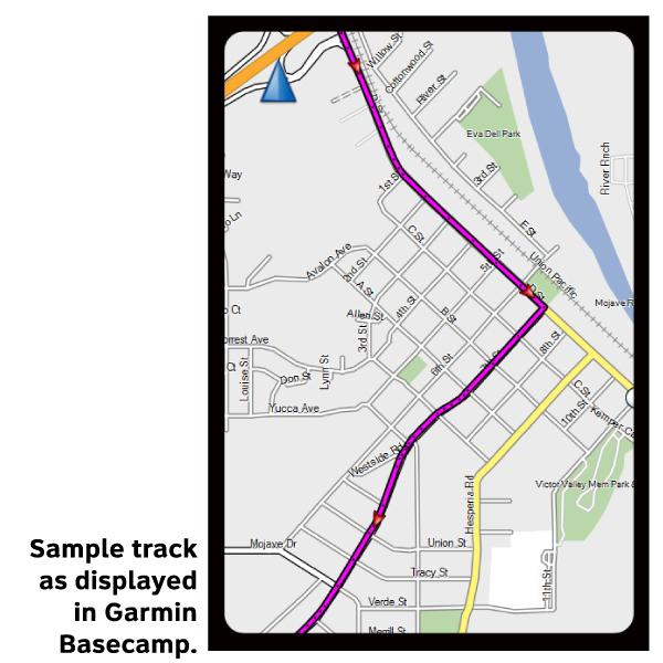
GPX Data products consist of track and service waypoint files in gpx (GPS Exchange Format) file format to be used on a GPS device, smartphone, or tablet. These products are suggested as a companion product to the printed Adventure Cycling Route maps and feature the same services listed on the physical maps. More information about GPX Data for Devices can be found here.
This map section begins in St. Louis, the largest city on Route 66 between Chicago and Los Angeles. In St. Louis the route follows city streets that require extra vigilance due to significant traffic. Plan your itinerary accordingly to get through the city and its suburbs. Missouri is hilly. Between St. Louis and Springfield, cyclists will encounter some bigger hills as you are riding through the northern reaches of the Ozark Mountains. The route parallels I-44 following frontage roads and flipping back and forth from either side of the interstate. Local traffic uses these roads while the majority of the through traffic will be on I-44. Officially recognized as the birthplace of Route 66, it was in Springfield that officials first proposed the name of the new Chicago-to-Los Angeles highway on April 30, 1926. Between Springfield and Joplin the route departs the Historic Route 66 corridor north of SR 96 in favor of several lesser traveled county and farm road.
More information about this route is available here.
GPX Data Resources
- GPX Data Agreement
- Support Pages for Digital Route Data products
- Map Updates and Corrections (Addenda) - Always be sure to check for map updates and corrections before leaving on your trip.
- Temporary Road Closure Information
- Frequently Asked Questions
* These products are delivered in compressed zip files. Instructions on extracting the data are located here.
**NOTE: Occasionally, the GPX data you purchase will be newer than the paper map currently being sold. They may still be used together. See the Tracks and Service Points FAQs for more information.**
You may also like:

Reviews
There are currently no reviews for this product, be the first!