These GPX Data products cannot be used with the Bicycle Route Navigator App! Unless you plan to use a standalone GPS device, we highly recommend purchasing route sections WITHIN the Bicycle Route Navigator app.
Please note, GPX Data is not refundable! Please examine the sample data on the device of your choice before purchasing GPX data packages. More information about GPX Data files can be found here.
After your GPX purchase, you can get GPX updates for free by re-downloading them from your My Adventure Cycling account.
GPX Data products consist of track and service waypoint files in gpx (GPS Exchange Format) file format to be used on a GPS device, smartphone, or tablet. These products are suggested as a companion product to the printed Adventure Cycling Route maps and feature the same services listed on the physical maps. More information about GPX Data for Devices can be found here.
Starting in St. Augustine, the route is urban/suburban most of the way down the coast through Miami. SR A1A along the ocean is adjacent to multiple aquatic preserves and wildlife refuges. Opportunities to enjoy the beach are plentiful and the county parks often include such amenities as picnic tables, cold water, showers and toilets. South of Jupiter, campgrounds for tenting are almost nonexistent until south of Miami. On the road to Key West the roadways have generous shoulders, though we recommend using the bike paths. Bahia Honda State Park, north of Key West, offers multiple opportunities to enjoy and learn about the reef environment of the Keys. Choose from activities such as snorkeling, windsurfing and visiting the museum exhibits. To create a loop route from Key West, a ferry is available to Fort Myers where it is possible to join the Florida Connector map route and return to Fort Lauderdale. Space is limited on the ferries, so when you make your reservations, be sure to let them know in advance that you have a bike. Click on enlargement for detail.The 59.5 mile Savannah spur begins in Register, Georgia, and parallels I-16, so expect local traffic on it. Traffic increases as you near downtown. The last half-mile of the route winds through three small squares in the historic district. The route south from Statesboro is rural and occasionally traverses pine plantations. A highlight of this section is the Okefenokee National Wildlife Refuge, located on the Okefenokee Alternate. Expect urban riding conditions while skirting Jacksonville, Florida, and the string of beach comunities to the south. Roads in northern Florida have somewhat higher traffic levels than found in Georgia. The route ends in historic St. Augustine, FL. Click on enlargement for detail.
More information about this route is available here.
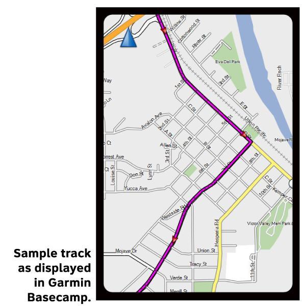
* These products are delivered in compressed zip files. Instructions on extracting the data are located here.
**NOTE: Occasionally, the GPX data you purchase will be newer than the paper map currently being sold. They may still be used together. See the Tracks and Service Points FAQsfor more information.**
Used the paper and digital ACA map to ride from Pompano Beach just north of Fort Lauderdale to Key West, 216 miles February 2017. The first part of the route is highly urbanized, often riding on very busy streets, often without a bike shoulder. If your GPS shows turns that are coming up it will make your life easier. The Keys starting around 10 miles north of Marathon and south are still recovering. Food and water are there, just have to look close to see what is open as many signs were blown away. No problems riding except some of the bike bridges were closed and some sections of bike paths were "washed" out.
seems to work okay
Rating:
Reviewed By:
hal on 1/25/17
i bought this and the locus map (android) . Looks interesting. I going to use this on a trip from key west to savannah ga. proof will be inthe pudding. Wondering if there is an update process.