Atlantic Coast Section 3 GPX Data


Please note, GPX Data is not refundable! Please examine the sample data on the device of your choice before purchasing GPX data packages. More information about GPX Data files can be found here.
After your GPX purchase, you can get GPX updates for free by re-downloading them from your My Adventure Cycling account.
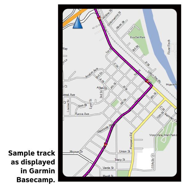
GPX Data products consist of track and service waypoint files in gpx (GPS Exchange Format) file format to be used on a GPS device, smartphone, or tablet. These products are suggested as a companion product to the printed Adventure Cycling Route maps and feature the same services listed on the physical maps. More information about GPX Data for Devices can be found here.
In Conshohocken, you'll use the Schuylkill Trail, cross the Schuylkill River, and continue on a bike path through Valley Forge National Historic Park. You might see Amish horse drawn carriages on the quiet roads near Bowmansville. Hills in this area are not severe, but the country certainly isn't flat. You'll cross the Susquehanna River between Columbia and Wrightville. In northern Maryland, there are a few short, steep descents; caution is advised because of the short sight distances. Nearing Baltimore, two route options are available. The main route skirts the city to the west, using county roads that are often hilly. The Chesapeake Bay Alternate through Baltimore avoids most of the heavy traffic north of the city. Entering Washington, D.C. the route uses the Rock Creek and the Capital Crescent trails. In Virginia, for the most part you'll be riding on occasionally busy well-signed and well-surfaced network of county roads. The terrain is rolling, with a few steep hills. Click on enlargement for detail.
More information about this route is available here.
GPX Data Resources
- GPX Data Agreement
- Support Pages for Digital Route Data products
- Map Updates and Corrections (Addenda) - Always be sure to check for map updates and corrections before leaving on your trip.
- Temporary Road Closure Information
- Frequently Asked Questions
* These products are delivered in compressed zip files. Instructions on extracting the data are located here.
**NOTE: Occasionally, the GPX data you purchase will be newer than the paper map currently being sold. They may still be used together. See the Tracks and Service Points FAQs for more information.**
You may also like:
Reviews
There are currently no reviews for this product, be the first!