These GPX Data products cannot be used with the Bicycle Route Navigator App! Unless you plan to use a standalone GPS device, we highly recommend purchasing route sections WITHIN the Bicycle Route Navigator app.
Please note, GPX Data is not refundable! Please examine the sample data on the device of your choice before purchasing GPX data packages. More information about GPX Data files can be found here.
After your GPX purchase, you can get GPX updates for free by re-downloading them from your My Adventure Cycling account.
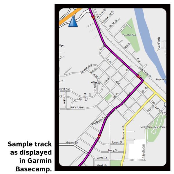
GPX Data products consist of track and service waypoint files in gpx (GPS Exchange Format) file format to be used on a GPS device, smartphone, or tablet. These products are suggested as a companion product to the printed Adventure Cycling Route maps and feature the same services listed on the physical maps. More information about GPX Data for Devices can be found here.
The Allegheny Mountains Loop offers a wide variety of riding types from pavement to gravel, from gentle grades along river valleys to steep, muscle burning climbs and fast descents over ridges, and from busy U.S. highways to lightly trafficked county roads and rail trails where no cars are allowed. Besides the main route there are 3 options which give the cyclist choices in the mileage they choose to ride. The route begins and ends in Blacksburg, VA, and crosses back and forth between Virginia and West Virginia several times. Highlights along the route include the Humpback Covered Bridge, Cass Scenic Railroad State Park, and excursion train rides from the town of Durbin.
More information about this route is available here.
* These products are delivered in compressed zip files. Instructions on extracting the data are located here.
**NOTE: Occasionally, the GPX data you purchase will be newer than the paper map currently being sold. They may still be used together. See the Tracks and Service Points FAQsfor more information.**
Reviews
Average rating: based on 1 reviews.
Nice maps
Rating:
Reviewed By:
D. Pineiro on 9/7/18
These maps feel like that are printed on some sort of vinyl. This makes them waterproof, although I have not tested this myself. The maps come with all sorts of information, including information about amenities at various locations that you will be traveling to during your ride, elevation gain chart per a segment, and a somewhat detailed topographical map.