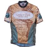
Lewis & Clark Map Set

Map Details
Hartford, IL - Seaside, OR (3,543.8 miles)
Product Code
BC-4000
Brand
Adventure Cycling Association
Price
$126.00
Current Stock
16

**Note: Map sets are separate inventory and can only be sold and returned as map sets. We are unable to return individual maps if purchased as a set.**

For the ultimate Lewis and Clark experience in 2007 and beyond, the Lewis & Clark Bicycle Trail is the only way to go. This Adventure Cycling route follows the famous explorers' trail as closely as possible and includes options for the different routes the corps took on their return trip.

Major funding for the Lewis & Clark Bicycle Trail has been provided by REI.

For more information on this route or to print out the most up to date addenda for these maps please click here.

Map Resources


You may also like:

Lewis & Clark Jersey
$85.00 $21.25 (Sale Price)

Reviews

Average rating: based on 5 reviews.

Missoula, MT to Circle, MT

Rating:

Reviewed By: Emily Gibson on 7/6/19

We have a mixed feeling about the sections of the Lewis & Clark trail we utilized, from Missoula MT to Circle, MT. We took this section to connect between the Trans Am and the Northern Tier routes, because we were too early in the year for the Going to the Sun road on the NT. While we met some of the most wonderful people on this route (Must stop in at Brockway Supper Club to say hello to Bev, baker of great brownies), saw some incredible scenery, and enjoyed the hospitality of so many small towns and city parks, this was the most difficult section of our cross-country tour due to weather and roads. Of course, weather is out of ACA's control, but if you are going through MT, pay attention to weather and utilize Doppler radar. Thunder/lightening storms come up quick, and the shelters are few and far between. Be prepared to take longer than you expect or go further than you expect on any given day. The route along MT-200 was especially difficult due to the roads (rumble strips, no shoulders, numbing bumps from tar on the ice cracks, and fast, fast drivers). The section from Lincoln to Augusta, there are no services and unless you wild camp, you need to do this whole stretch in one day, so watch the weather carefully! The information on the maps was accurate, for lodging, food, etc. Very helpful as we tried to figure out how far we could go each day! We thoroughly enjoyed the section from Great Falls through Ft. Benton, Geraldine (Rusty's is the best little small-town bar-diner ever!! Say hello to Dena!) and Lewistown, which was off of MT-200. Small-town America at its best. The section from near Mosby to Circle had the roughest roads. We considered that perhaps following a historical route makes it more difficult to keep to the best route for bicycles, but we also recognize that all routes through MT are problematic, from the fracking trucks, etc. At any rate, we just wanted people to know the difficulties we encountered with the roads and weather, the last week of May/first week of June.

Full set Lewis & Clark trail maps

Rating:

Reviewed By: Marilyn Courrier on 2/21/17

I have only used one section so far, but I find these maps to be superb! I keep reading them over and over again for all the information they contain - campsites, stores, water. We intend to do the whole route over a few summers. Keep up the good work!

GPS coordinates

Rating:

Reviewed By: Fred Musburger on 8/4/15

Bought this and added "Lewis and Clark Trail, Today" that is a great companion to this product. Lewis and Clark Trail, Today provides over 1,000 gps coordinates of exact location of campsites and 1,000+ photographs of campsites. Works great to find the actual locations of sites.

Lewis and Clark

Rating:

Reviewed By: A customer from Munfordville Kentucky on 10/7/10

The Maps Gave me a lot of guidance and direction.... Although I believe that there were to many alternate routes that seemed to be very confusing... I would love to see routes guided towards one path instead of multiple areas, spots and Locations... I

Lewis & Clark Map Set

Rating:

Reviewed By: Larry moormeier on 12/3/09

Spring 2010 I plan to ride Lewis and Clark route which will be the fifth time using AC maps (East Coast, TransAm, Lewis & Clark, URR and Southern Crossing) on 6-8 weeks tours. All the maps have been top quality regarding routing,information for planning the ride and use on the actual ride.

Show More Reviews


Add Product Review